I am trying to understand the map. In this area it lists multiple LTE antennas but there is only one on the left which is correct. Why are those other ones listed? They also have different CellIDs when I click on them. Also the map shows a red mark for a CDMA I drove around the area but I didn’t see anything on that location. Am I looking at the map incorrectly?
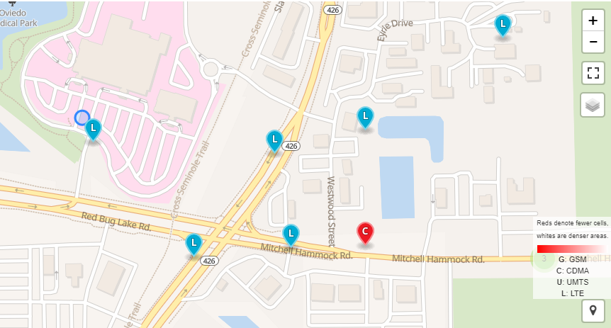
A cell tower can have multiple cells on it. There is also a possibility that older cells were upgraded resulting in the OpenCelliD database showing identifiers of both the older cell and the newer one, when in reality there is just the newer cell present.
This database seems rife with errors, it’s like every time someone uses the app it guesses there’s a mast in a certain location. What is that location based off of? Compare the data with CellMapper which only does one network + provider at a time (a sketchy looking but brilliant mast+signal tracker app)