I’m trying to use this dataset as part of my research. I want to find all cell towers in San Francisco. I figured out San Francisco has four Location Area Codes: 650, 415, 510, and 628. Therefore, I collected all rows which contain these LACs. When I checked these points (Latitude, Longitude) the Google map strangely point me to places outside California e.g. Atlanta and Canada. Please help me know how to find the cell tower rows in San Francisco county.
As an example, I have provided the following line from file 302.csv of the united states:
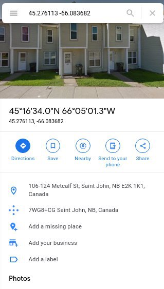
index radio mcc net area cell unit lon lat range samples changeable created updated averageSignal
841346 LTE 302 270 650 5761537 0 -66.083682 45.276113 1000 3 1 1532995742 1587321349
But the google map shows that this place is somewhere in Canada, not California.